As the 2025 season begins to pick up momentum, it seems a good time to highlight a selection of new features that are available to event organisers and race directors this year. We’ve been hard at work developing over the winter – adding functionality to the platform and extending existing features.
Many of the new developments are based on requests and feedback from last year. If you have a feature you would like to see added or amended, you can request it here.
Checkpoint Pop-ups
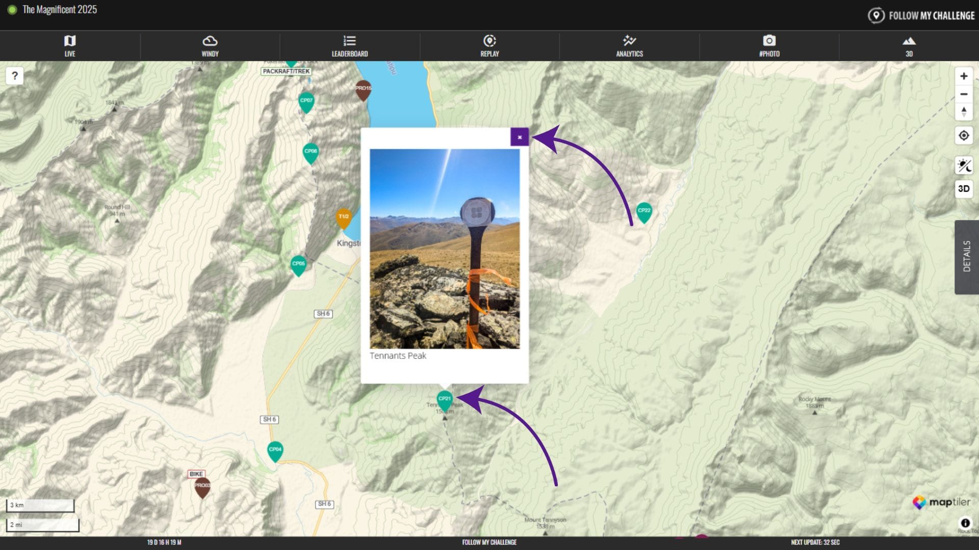
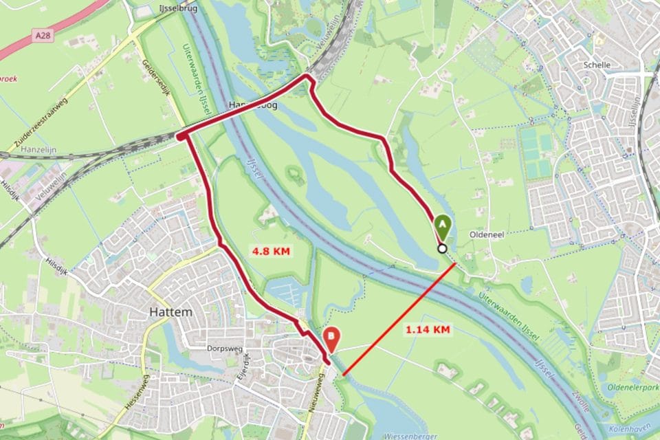
All new maps now have clickable checkpoint pop-ups enabled. These pop-ups appear beside the checkpoint when the checkpoint is clicked and can contain text, images or links. Organisers can submit this content as part of the map build process. To close the pop-up, simply click on the “x” in the top right corner.
Expanded Overdrive Mode
Our existing “Overdrive Mode” feature takes advantage of our ability to remotely control our Queclink trackers, changing their update interval as participants approach the finish. Previously, this was set to switch to 1 minute intervals in the final 15 km. Moving forwards, this will now adjustable between maps, allowing us to optimise for shorter events, where an even shorter interval will give greater precision.
On top of this, we have also added the ability for any checkpoint to trigger an interval change. This new feature opens up the possibility of timed segments within longer events, which was previously difficult to achieve with standard five-minute intervals.
Revamped Agreement Form
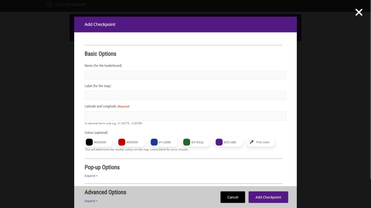
We’ve revamped our tracking agreement and map building form, allowing for much greater detail when organisers are submitting their event information. This includes nested forms for routes, checkpoints and logos, allowing organisers to customise the maps to their liking – controlling colours, links and pop-up content all in one location.
Direct Manager Login Links
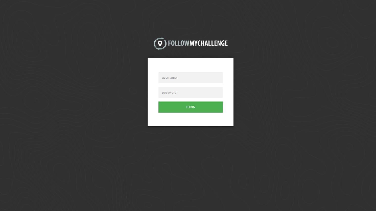
Event organisers will now have the option of access to the manager via a direct URL that logs you in automatically. This works alongside the existing username/password functionality, but it makes it much easier to log in without having to copy or remember complicated passwords. This link will be shared in the “map ready” emails that go out to all organisers.
Mobile Mode in the Manager
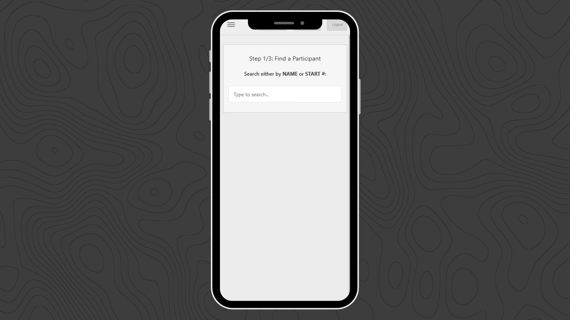
We know just how many of the organisers we work with are in the field during their events, often accessing our map manager exclusively from their phone. With this in mind, we have added a mobile mode to the Participants tab of the manager. Logging in on a mobile phone will now redirect you to this tab by default, giving you the option to browse in mobile mode.
This new mobile mode dispenses entirely with the traditional table view and implements a searchable form-based approach instead. You can quickly and easily search for a participant, before then selecting the action you would like to apply, such as marking them as DNF, switching their group or applying a finish correction.
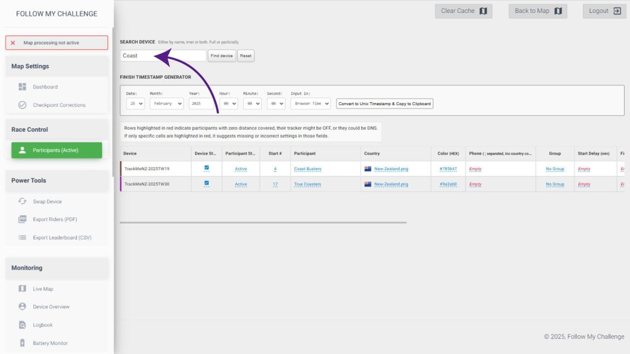
Search Feature for Participants

The Participants tab also now features a search function, removing the need for scrolling through countless names or cap numbers. You can quickly search by name – including using partial names – or by start number to locate a participant. The table will update to show all possible matches, allowing you to isolate the participant you’re looking for an apply any necessary changes.
SMS Alerts at Checkpoints
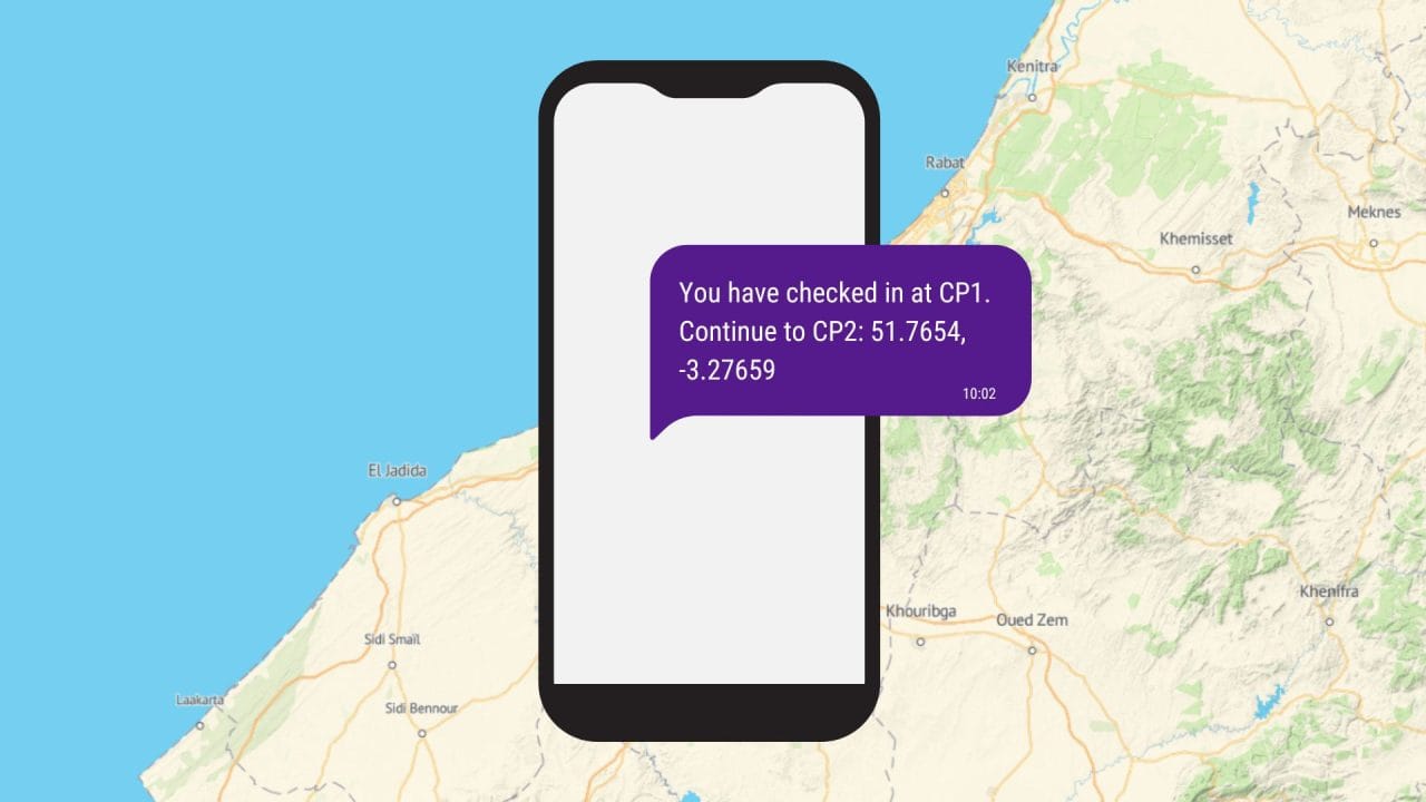
Checkpoint detection can now be used to trigger SMS messages to participants. We’ve added a phone number field to the manager, allowing you to load one or more phone number per tracker. Checkpoints can then be set to send a bespoke message to the number(s) associated with a tracker when it is detected nearby. This feature is ideal for events where the next checkpoint location is revealed at the previous checkpoint, allowing for the process to be automated.
On top of this, we have also added the ability for event organisers to receive SMS notifications when participants arrive at a checkpoint. This is an opt-in feature that organisers can let us know if they require. It works alongside our existing finish alerts, which can trigger an SMS when a participant is a certain distance from the finish.
Support Site Launched
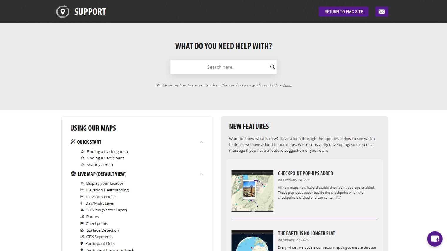
It has always been our aim to build and maintain a tracking platform that is naturally intuitive and easy to use, even for the casual dotwatcher. However, as our platform grows and evolves, we understand that there are more and more features hidden away within our maps.
In order to retain the ease of use that is at the core of what we do – as well as to throw some light on features that might get overlooked – we have created a support site that can guide you through the different tabs, buttons and layers on our maps. This is laid out in an easy-to-follow structure with accompanying screenshots. It includes a search feature, as well as an AI chatbot that can help you find what you’re looking for.
Update: We’ve also launched a support site dedicated to our map manager, which all organisers will get access to
Profile Tags (Beta)
You may have noticed last year that several maps featured links to participants’ Instagram accounts in the Details menu and pop-up. We’re expanding this in 2025 to include more fields, including profile photos, and you will begin to see a number of events testing this new feature as we develop it further.
If you’re keen to use this feature for your event then please get in touch with us. We can then provide you with details on how the data needs to be provided to make this feasible.