Several years ago, we first began testing our geofencing feature. It has been in beta mode since then and has been used across several events. Based on this testing, as well as valuable feedback from organisers, we have made significant improvements to how it works. We’re excited to officially launch it and make it available to all events using our Queclink devices.
What is Geofencing?
This is an optional safety/privacy feature that is activated using the function button on our Queclink trackers. The aim is to obscure or blur the participant’s location, aiding privacy or safety in areas where they may not want their location broadcast.
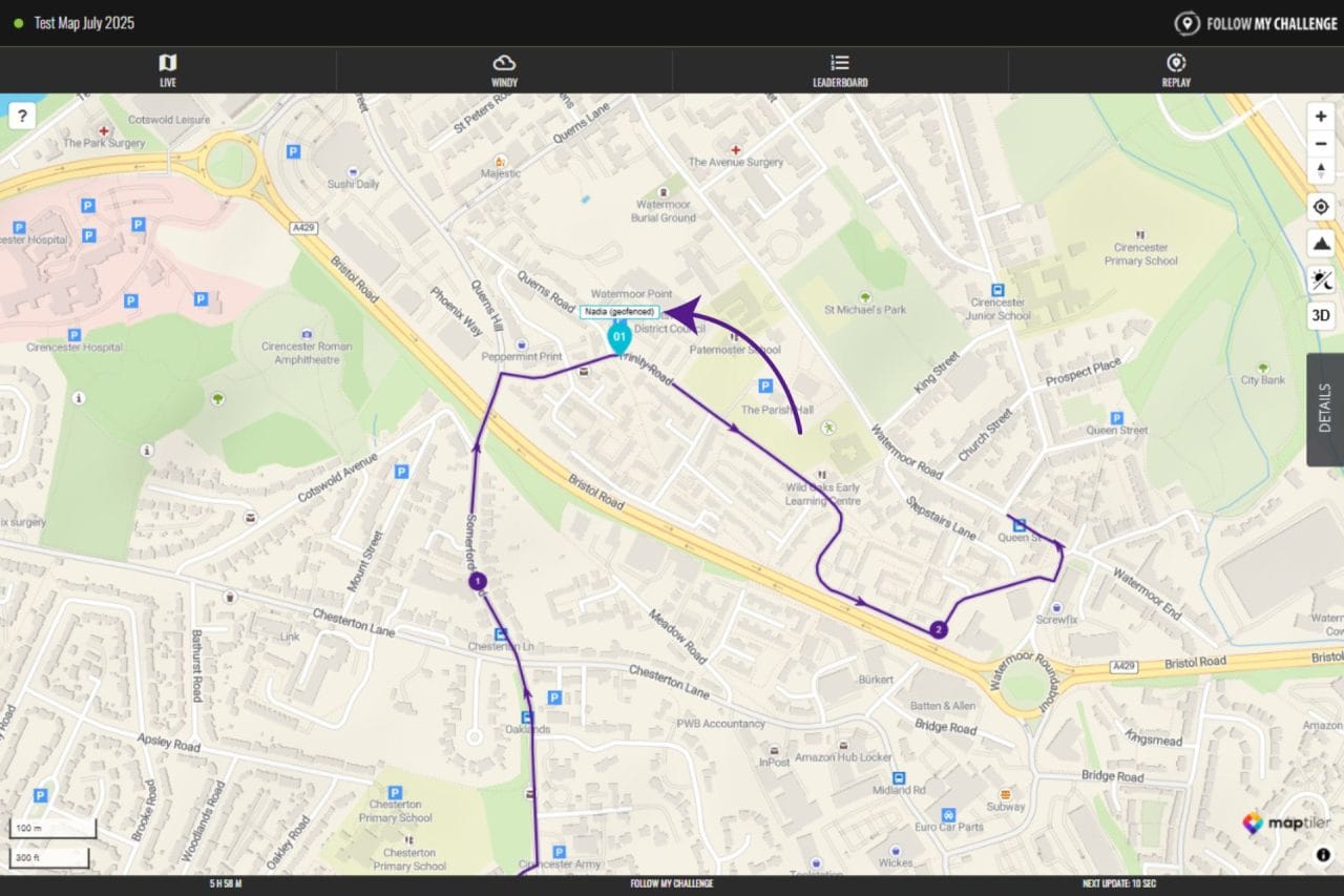
When a participant is geofenced, their real location is hidden from public view. You are able to see the last tracking point their device sent from outside the geofenced area. On the map, you will see “geofenced” beside their dot. There will also be a “geofenced” label beneath their name in the Details tab.
How does geofencing work?
To create the geofence, the participant needs to hold the function button on their tracker for 3-4 seconds or until it vibrates. This immediately creates a geofenced area from that point, cloaking any past or future tracking points within a pre-set radius (usually a few kilometres).
While the participant remains within this geofenced area, their position will not update on the map and viewers will only be able to see their last position outside of the geofenced area (which will display that they are geofenced). The event organiser will be able to see their real location by logging into the map manager.
When the participant leaves the geofenced area, their location will begin updating on the map again. All previously geofenced tracking points will also display, allowing viewers to verify where they were during this period – important for events that have strict rules on self sufficiency.
Will all events have geofencing?
No, organisers must opt in to enable geofencing, as it is important that participants understand how it works. Furthermore, it is only possible using our Queclink trackers, so events using SPOT trackers or other satellite trackers will not be able to use it.