The elevation profile feature has been upgraded ahead of the 2026 season. Opened using a button on in the top-right of the map, the elevation profile has been rebuilt from scratch to introduce a range of new features. Alongside this, we have also focused on improving performance on mobile, as well as handling of multiple routes.
Amongst the new features added, the most immediately noticeable will be support for surface types: unpaved sections now show up with lighter shading beneath them, allowing you to work out exactly which climbs and descents are off road. Alongside this, participant dots are now colour matched on the elevation profile, with dynamic switching between full names and initials as you zoom.
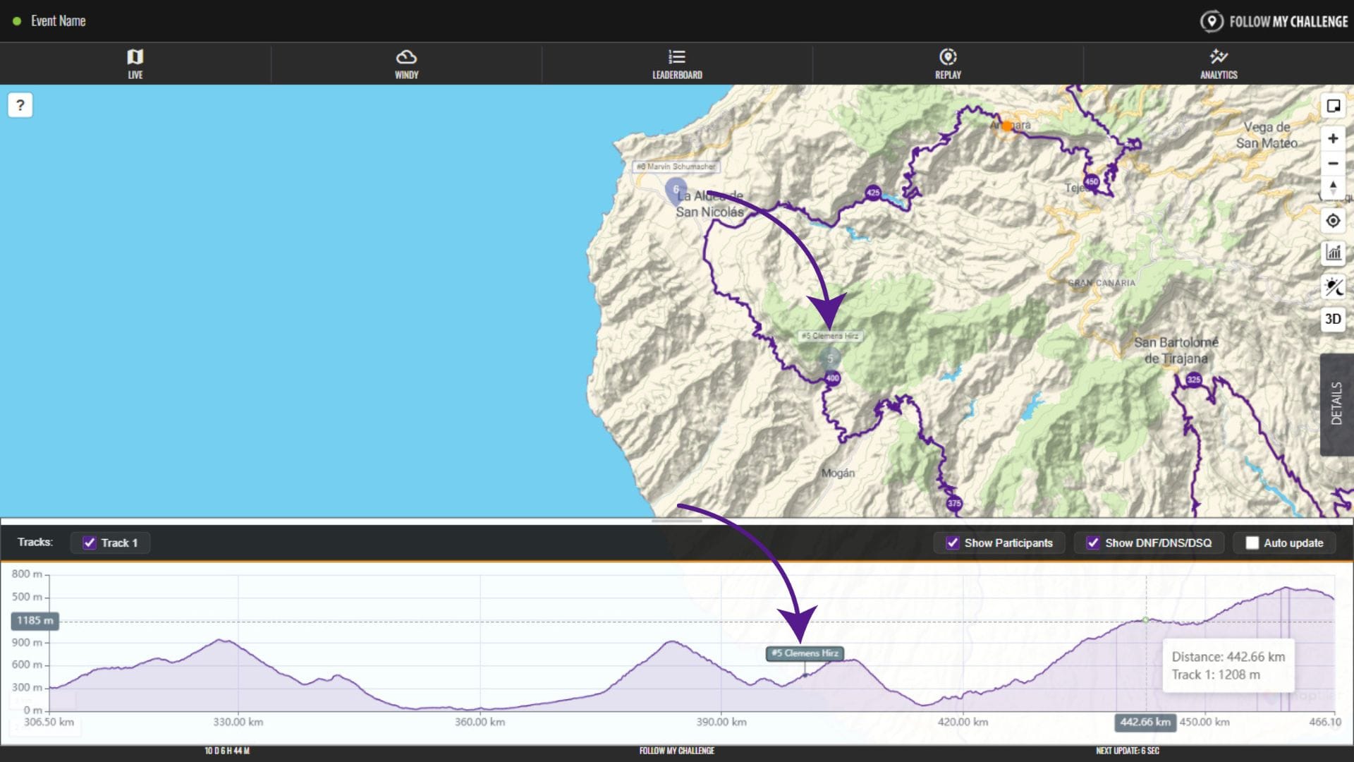
More filtering has also been built in, with the option to hide DNF participants or hide/show different routes. And checkpoints now appear on the profile, allowing you to work out where they sit relative to participants in terms of elevation. Finally, you can also click or hover on a point on the elevation profile and it will highlight that point on the route, as well as showing you the elevation and distance.